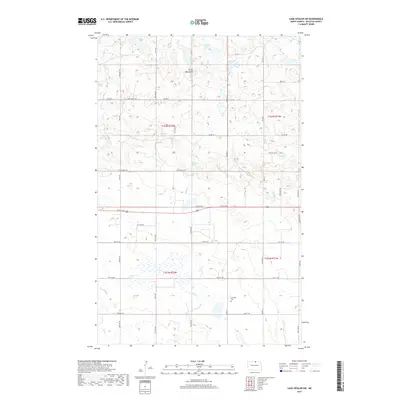
2017 Map of Lake Upsilon SW
USGS Topo · Published 2017About this map
The Turtle Mountains dominate the northern landscape of this Rolette County region, where the terrain transitions from upland peaks into the wetlands and prairies of the plains. This 2017 survey details a network of water features including Johnson Lake, Howard Lake, and the Holywater Spring, illustrating the complex hydrology characteristic of this glacial geography. The southern half of the map shows a shift toward agricultural land use, organized by a rigid grid of Bureau of Indian Affairs roads and local routes like 3 Mile Rd and 96th St NE. The presence of the Lakeview Cem near Snake Cr provides a specific point of interest for genealogists tracing local families in Shell Valley. Throughout the area, ephemeral drainage patterns are visible along Mud Cr, documenting the environmental state of the watershed in the early 21st century.
Find a feature on this map
34 named features on this map. Tap any name to fly to it.
Don’t see what you’re looking for? This feature index may not catch every label — zoom into the map to look around manually.
Map Details
Editions of this 2017 Lake Upsilon SW Map
This is the sole edition of this map. No revisions or reprints were ever made.
Other maps of this area

1935 · Dunseith
USGS Topo · 1:48,000

1936 · Lake Upsilon
USGS Topo · 1:48,000

1939 · Dunseith
USGS Topo · 1:62,500

1942 · Lake Upsilon
USGS Topo · 1:62,500

1953 · Devils Lake
USGS Topo · 1:250,000

1954 · Minot
USGS Topo · 1:250,000

1955 · Fonda
USGS Topo · 1:24,000

1955 · Thorne
USGS Topo · 1:24,000

1955 · Dunseith
USGS Topo · 1:24,000

1955 · Lake Upsilon SW
USGS Topo · 1:24,000