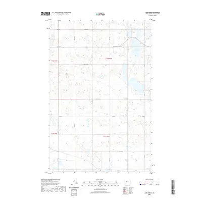
2020 Map of Lake Vernon
USGS Topo · Published 2020About this map
Lake Vernon dominates the northeastern corner of this Ward County landscape, surrounded by a complex network of wetlands and prairie potholes. The terrain is organized by the Public Land Survey System, with boundaries such as t152n r85w and t151n r85w defining the administrative grid. This 2020 survey illustrates a primarily rural environment where transportation is dictated by a strict rectilinear grid of section-line roads, including Co Hwy 22 and Co Hwy 13. The high density of unnamed seasonal ponds and small water bodies across the quadrangle reflects the characteristic glacial geomorphology of the North Dakota plains, showing how local hydrology continues to influence the placement of thoroughfares like 289th Ave Sw and 345th Ave Sw.
Find a feature on this map
19 named features on this map. Tap any name to fly to it.
Don’t see what you’re looking for? This feature index may not catch every label — zoom into the map to look around manually.
Map Details
Editions of this 2020 Lake Vernon Map
This is the sole edition of this map. No revisions or reprints were ever made.
Other maps of this area

1928 · Minot
USGS Topo · 1:62,500

1954 · Minot
USGS Topo · 1:250,000

1954 · McClusky
USGS Topo · 1:250,000

1956 · Blue Hill
USGS Topo · 1:24,000

1956 · Douglas West
USGS Topo · 1:24,000

1958 · McClusky
USGS Topo · 1:250,000

1958 · Minot
USGS Topo · 1:250,000

1980 · Minot
USGS Topo · 1:100,000

1980 · Lake Vernon
USGS Topo · 1:24,000
1980 · Douglas East
USGS Topo · 1:24,000