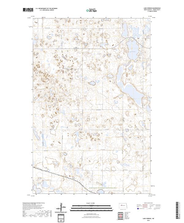
2024 Map of Lake Vernon
USGS Topo · Published 2024About this map
Lake Vernon sits at the heart of this prairie landscape in Ward County, surrounded by a complex system of seasonal wetlands and small basins. The northeastern corner of the map is defined by this significant water body, while the southern reaches include the Ward County Waterfowl Production Area. The terrain is characterized by the irregular depressions of the Missouri Coteau, a glacial landscape where drainage is internally focused into numerous small ponds and sloughs.
Find a feature on this map
20 named features on this map. Tap any name to fly to it.
Don’t see what you’re looking for? This feature index may not catch every label — zoom into the map to look around manually.
Map Details
Editions of this 2024 Lake Vernon Map
This is the sole edition of this map. No revisions or reprints were ever made.
Other maps of this area

1928 · Minot
USGS Topo · 1:62,500

1954 · Minot
USGS Topo · 1:250,000

1954 · McClusky
USGS Topo · 1:250,000

1956 · Blue Hill
USGS Topo · 1:24,000

1956 · Douglas West
USGS Topo · 1:24,000

1958 · McClusky
USGS Topo · 1:250,000

1958 · Minot
USGS Topo · 1:250,000

1980 · Minot
USGS Topo · 1:100,000

1980 · Lake Vernon
USGS Topo · 1:24,000
1980 · Douglas East
USGS Topo · 1:24,000