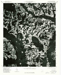
1976 Map of Lake View
USGS Topo · Published 1978About this map
Lake View serves as the primary hub of this 1976 orthophotoquad, which captures the agricultural patterns of Dillon County, South Carolina, and the borderlands of North Carolina during the mid-1970s. The aerial imagery highlights a landscape defined by an intricate mosaic of cleared farmland and dense woodland, reflecting the region's long-standing reliance on tobacco and cotton cultivation. The small settlement of Hodgesville is visible to the north, while May Hilltop sits to the west, connected by a network of rural roads that follow the natural contours of the land. This visual record is particularly valuable for genealogists and local historians, as it documents the exact footprint of homesteads and field boundaries before later rural development or changes in land use altered the traditional Southern agrarian layout.
Find a feature on this map
3 named features on this map. Tap any name to fly to it.
Don’t see what you’re looking for? This feature index may not catch every label — zoom into the map to look around manually.
Map Details
Editions of this 1976 Lake View Map
This is the sole edition of this map. No revisions or reprints were ever made.
Other maps of this area

1943 · Pages Mill
USGS Topo · 1:62,500

1946 · Mullins
USGS Topo · 1:24,000

1947 · Mullins
USGS Topo · 1:24,000

1948 · Nichols
USGS Topo · 1:24,000

1949 · Duford
USGS Topo · 1:24,000

1950 · Nichols
USGS Topo · 1:24,000

1953 · Florence
USGS Topo · 1:250,000

1954 · Florence
USGS Topo · 1:250,000

1959 · Fork
USGS Topo · 1:24,000

1960 · Dillon East
USGS Topo · 1:24,000