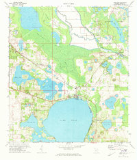
1970 Map of Lake Weir
USGS Topo · Published 1973About this map
Lake Weir dominates the southern landscape of this 1970 survey, surrounded by established lakeside communities and complex hydraulic works. The settlement of Oklawaha serves as a focal point near the northern shore, while the Seaboard Coast Line railroad cuts through the western citrus and timber lands, connecting Candler to the wider regional trade network. The map captures the intricate water management system of the era, highlighted by the Moss Bluff Lock and Dam and the winding course of the Oklawaha River as it moves toward the Ocala National Forest.
Find a feature on this map
39 named features on this map. Tap any name to fly to it.
Don’t see what you’re looking for? This feature index may not catch every label — zoom into the map to look around manually.
Map Details
Editions of this 1970 Lake Weir Map
4 editions found
Other maps of this area

1893 · Panasoffkee
USGS Topo · 1:62,500

1895 · Panasoffkee
USGS Topo · 1:62,500

1895 · Ocala
USGS Topo · 1:62,500

1954 · Gainesville
USGS Topo · 1:250,000

1954 · Daytona Beach
USGS Topo · 1:250,000

1955 · Plant City
USGS Topo · 1:250,000

1955 · Orlando
USGS Topo · 1:250,000

1957 · Orlando
USGS Topo · 1:250,000

1958 · Orlando
USGS Topo · 1:250,000

1958 · Daytona Beach
USGS Topo · 1:250,000