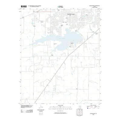
2010 Map of Lake Wichita
USGS Topo · Published 2010About this map
Lake Wichita anchors this south Texas landscape, serving as a focal point for the growing suburbs and rural tracts south of Witchita Falls. The map documents a transition from the dense street grids of neighborhoods like Allendale and the developed shores of Lakeside City to the expansive ranch and oil lands to the south. Significant local infrastructure is visible, including the Lake Wichita Dam and the Tom Danaher Airport, alongside a concentration of memorial sites such as Lakeview Cemetery, Rest Cemetery, and Crestview Memorial Park Cemetery.
Find a feature on this map
50 named features on this map. Tap any name to fly to it.
Don’t see what you’re looking for? This feature index may not catch every label — zoom into the map to look around manually.
Map Details
Editions of this 2010 Lake Wichita Map
This is the sole edition of this map. No revisions or reprints were ever made.
Other maps of this area

1916 · Iowa Park
USGS Topo · 1:24,000

1918 · Iowa Park
USGS Topo · 1:31,680

1931 · Archer City
USGS Topo · 1:62,500

1954 · Wichita Falls
USGS Topo · 1:250,000

1956 · Sloop Creek
USGS Topo · 1:24,000

1956 · Lake Wichita
USGS Topo · 1:24,000

1957 · Wichita Falls West
USGS Topo · 1:24,000

1957 · Wichita Falls East
USGS Topo · 1:62,500

1957 · Wichita Falls East
USGS Topo · 1:24,000

1957 · Wichita Falls West
USGS Topo · 1:62,500