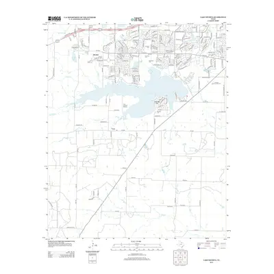
2012 Map of Lake Wichita
USGS Topo · Published 2012About this map
Lake Wichita dominates the central landscape of this North Texas region, serving as a focal point for the surrounding suburban and rural communities. In the early 21st century, the northern portion of the sheet shows the dense residential expansion of Wichita Falls, with neighborhoods like Allendale and the incorporated Lakeside City bordering the shoreline. This area is notably dense with local institutions, featuring Milam School and the American Commercial Coll, alongside a concentration of memorial sites including Rosemont Cem and Crestview Memorial Park Cem.
Find a feature on this map
176 named features on this map. Tap any name to fly to it.
Don’t see what you’re looking for? This feature index may not catch every label — zoom into the map to look around manually.
Map Details
Editions of this 2012 Lake Wichita Map
This is the sole edition of this map. No revisions or reprints were ever made.
Other maps of this area

1916 · Iowa Park
USGS Topo · 1:24,000

1918 · Iowa Park
USGS Topo · 1:31,680

1931 · Archer City
USGS Topo · 1:62,500

1954 · Wichita Falls
USGS Topo · 1:250,000

1956 · Sloop Creek
USGS Topo · 1:24,000

1956 · Lake Wichita
USGS Topo · 1:24,000

1957 · Wichita Falls West
USGS Topo · 1:24,000

1957 · Wichita Falls East
USGS Topo · 1:62,500

1957 · Wichita Falls East
USGS Topo · 1:24,000

1957 · Wichita Falls West
USGS Topo · 1:62,500