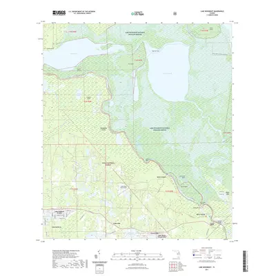
2021 Map of Lake Woodruff
USGS Topo · Published 2021About this map
The Saint Johns River defines the western corridor of this landscape, winding through the expansive wetlands of the Lake Woodruff National Wildlife Refuge. The river's serpentine course creates complex waterways such as Deadmans Bend, Devils Elbow, and the Saint Francis Dead River, which isolate landmasses like Tick Island and Dexter Island. This aquatic network was historically vital for navigation and remains a central feature for modern recreation, as evidenced by the St Johns River Blueway Trl.
Find a feature on this map
75 named features on this map. Tap any name to fly to it.
Don’t see what you’re looking for? This feature index may not catch every label — zoom into the map to look around manually.
Map Details
Editions of this 2021 Lake Woodruff Map
This is the sole edition of this map. No revisions or reprints were ever made.
Other maps of this area

1954 · Daytona Beach
USGS Topo · 1:250,000

1955 · Orlando
USGS Topo · 1:250,000

1957 · Orlando
USGS Topo · 1:250,000

1958 · Orlando
USGS Topo · 1:250,000

1958 · Daytona Beach
USGS Topo · 1:250,000

1962 · Orlando
USGS Topo · 1:250,000

1962 · Pine Lakes
USGS Topo · 1:24,000

1962 · Lake Woodruff
USGS Topo · 1:24,000

1964 · Daytona Beach
USGS Topo · 1:250,000
1964 · De Land
USGS Topo · 1:24,000