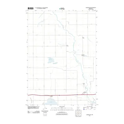
2010 Map of Lakefield NE
USGS Topo · Published 2010About this map
The Des Moines River winds through this agricultural landscape in Jackson County, shaping the drainage patterns of southern Minnesota. The terrain is defined by an extensive network of engineered waterways, including Judicial Ditch Number Twentythree, Judicial Ditch Number Thirtyseven, and Judicial Ditch Number Eightytwo, which support the region's productive farmland. The presence of both the East Belmont Cemetery and West Belmont Cemetery provides a clear link to the area's early settlement history and the families who established the Belmont community. Water management remains central to the area's modern configuration, as evidenced by the Tillman Gruhlke Dam and the Doctor Tubola Detention Structure Dam. Natural water bodies like Boot Lake and the larger Clear Lake offer a contrast to the geometric grid of roads such as County Hwy 77, while dedicated rest areas near the lakes cater to travelers passing through this prairie-river corridor.
Find a feature on this map
35 named features on this map. Tap any name to fly to it.
Don’t see what you’re looking for? This feature index may not catch every label — zoom into the map to look around manually.
Map Details
Editions of this 2010 Lakefield NE Map
This is the sole edition of this map. No revisions or reprints were ever made.
Other maps of this area

1954 · Fairmont
USGS Topo · 1:250,000

1958 · Fairmont
USGS Topo · 1:250,000

1970 · Jackson NW
USGS Topo · 1:24,000

1970 · Lakefield SW
USGS Topo · 1:24,000

1970 · Lakefield NE
USGS Topo · 1:24,000

1970 · Jackson
USGS Topo · 1:24,000

1970 · Wilder
USGS Topo · 1:24,000

1970 · Lakefield SE
USGS Topo · 1:24,000

1970 · Lakefield
USGS Topo · 1:24,000

1970 · Windom
USGS Topo · 1:24,000