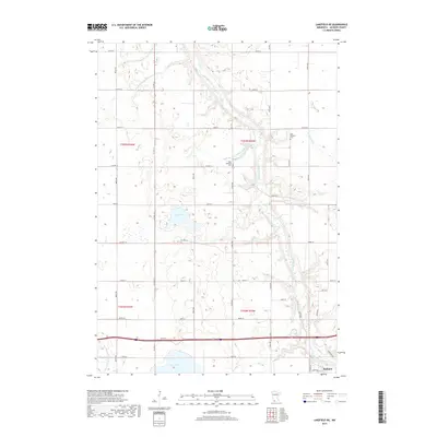
2019 Map of Lakefield NE
USGS Topo · Published 2019About this map
Jackson anchors the southern edge of this quadrangle, situated where the meandering Des Moines River cuts through the prairie landscape. The area is defined by an extensive network of water management, evidenced by numerous engineered waterways such as Judicial Ditch Number Eightytwo and Judicial Ditch Number Thirtyseven. These features reflect a legacy of land reclamation and drainage essential to the agricultural productivity of the region. Natural hydrology persists in the form of Boot Lake and the northern shores of Clear Lake, which provide a contrast to the geometric precision of the township and range survey lines.
Find a feature on this map
32 named features on this map. Tap any name to fly to it.
Don’t see what you’re looking for? This feature index may not catch every label — zoom into the map to look around manually.
Map Details
Editions of this 2019 Lakefield NE Map
This is the sole edition of this map. No revisions or reprints were ever made.
Other maps of this area

1954 · Fairmont
USGS Topo · 1:250,000

1958 · Fairmont
USGS Topo · 1:250,000

1970 · Jackson NW
USGS Topo · 1:24,000

1970 · Lakefield SW
USGS Topo · 1:24,000

1970 · Lakefield NE
USGS Topo · 1:24,000

1970 · Jackson
USGS Topo · 1:24,000

1970 · Wilder
USGS Topo · 1:24,000

1970 · Lakefield SE
USGS Topo · 1:24,000

1970 · Lakefield
USGS Topo · 1:24,000

1970 · Windom
USGS Topo · 1:24,000