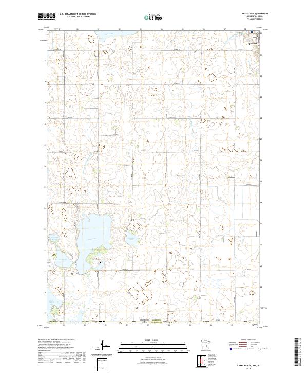
2022 Map of Lakefield SE
USGS Topo · Published 2022About this map
Jackson sits at the northeastern corner of this agricultural landscape, where the prairie of southern Minnesota meets the Iowa border. The terrain is defined by a dense network of glacial basins and water management systems, including Loon Lake, Chandler Lake, and Pearl Lake. Local history is anchored at the Loon Lake Cem, located near the southern shore of its namesake water body. The map illustrates a highly organized rural grid, with roads like Co Hwy 34 and 490th Ave facilitating movement between scattered farmsteads and wetlands. Significant hydraulic engineering is evident through labeled features such as Judicial Ditch Number Sixty-six and Judicial Ditch Number Eight, which reflect a long-standing regional effort to manage the hydrology of Andersons Marsh and surrounding lowlands for cultivation.
Find a feature on this map
45 named features on this map. Tap any name to fly to it.
Don’t see what you’re looking for? This feature index may not catch every label — zoom into the map to look around manually.
Map Details
Editions of this 2022 Lakefield SE Map
This is the sole edition of this map. No revisions or reprints were ever made.
Other maps of this area

1954 · Fairmont
USGS Topo · 1:250,000

1958 · Fairmont
USGS Topo · 1:250,000

1970 · Jackson NW
USGS Topo · 1:24,000

1970 · Lakefield SW
USGS Topo · 1:24,000

1970 · Lakefield NE
USGS Topo · 1:24,000

1970 · Jackson
USGS Topo · 1:24,000

1970 · Okoboji
USGS Topo · 1:24,000

1970 · Lakefield SE
USGS Topo · 1:24,000

1970 · Lakefield
USGS Topo · 1:24,000

1970 · Spirit Lake
USGS Topo · 1:24,000