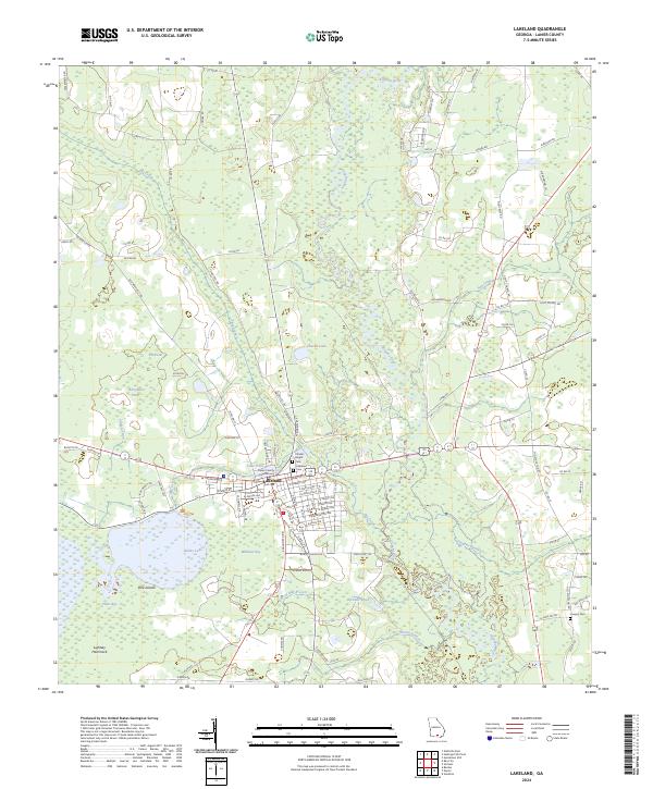
2024 Map of Lakeland
USGS Topo · Published 2024About this map
Lakeland serves as the seat of Lanier County, its civic center anchored by the Lanier County Courthouse near the shore of Lake Irma. The landscape is dominated by the expansive wetlands of the Banks Lake National Wildlife Refuge, where the waters of Banks Lake surround features such as the Pine Islands and Milltown Bay. This area illustrates a typical south Georgia coastal plain environment, defined by the slow-moving Alapaha River and a complex network of drainages including Big Creek, Dampier Branch, and Dorsey Mill Branch. Local history is preserved in several burial grounds, including the Charles Knight Cem and Lakeland Cem, while the surrounding timberland and agricultural plots are accessed via a dense grid of county roads like Old Nashville Rd and Teeterville Rd.
Find a feature on this map
112 named features on this map. Tap any name to fly to it.
Don’t see what you’re looking for? This feature index may not catch every label — zoom into the map to look around manually.
Map Details
Editions of this 2024 Lakeland Map
This is the sole edition of this map. No revisions or reprints were ever made.
Other maps of this area

1953 · Waycross
USGS Topo · 1:250,000

1954 · Valdosta
USGS Topo · 1:250,000

1958 · Valdosta
USGS Topo · 1:250,000

1958 · Waycross
USGS Topo · 1:250,000

1959 · Valdosta
USGS Topo · 1:250,000

1968 · Naylor
USGS Topo · 1:24,000

1968 · Lakeland
USGS Topo · 1:24,000

1971 · Stockton
USGS Topo · 1:24,000
1971 · Bemiss
USGS Topo · 1:24,000

1972 · Sirmans
USGS Topo · 1:24,000