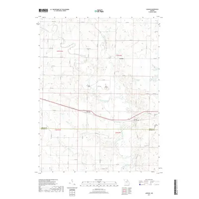
2017 Map of Lakenan
USGS Topo · Published 2017About this map
Lakenan and Kendall sit at the center of this rural landscape, where the North Fork Salt River and its numerous tributaries like Black Cr and Thomas Cr carve through the Missouri countryside. This 2017 survey details a landscape defined by water and rail, with the Salt River Railroad Bridge carrying traffic across the river just east of Lakenan. The topography is anchored by The Mound, a prominent rise north of the river, and several large water bodies including Hunnewell Lake and Paradise Lake. Genealogists and local historians can locate several important sites, including the Hunnewell Cem and Saint Johns Cem, as well as the historic crossing at Kincheloe Bridge. The border between Shelby Co and Monroe Co runs through the southern portion of the map, illustrating how these administrative lines follow the drainage patterns of Brush Cr and Jackson Cr.
Find a feature on this map
64 named features on this map. Tap any name to fly to it.
Don’t see what you’re looking for? This feature index may not catch every label — zoom into the map to look around manually.
Map Details
Editions of this 2017 Lakenan Map
This is the sole edition of this map. No revisions or reprints were ever made.
Other maps of this area

1903 · Palmyra
USGS Topo · 1:125,000

1948 · Quincy
USGS Topo · 1:250,000

1953 · Moberly
USGS Topo · 1:250,000

1954 · Moberly
USGS Topo · 1:250,000

1956 · Quincy
USGS Topo · 1:250,000

1957 · Moberly
USGS Topo · 1:250,000

1959 · Shelbina
USGS Topo · 1:24,000

1959 · Lakenan
USGS Topo · 1:24,000

1959 · Hunnewell
USGS Topo · 1:24,000

1960 · Moberly
USGS Topo · 1:250,000