
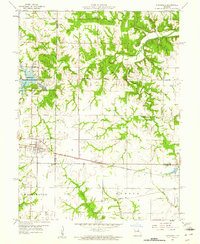
1959 Map of Hunnewell
USGS Topo · Published 1961About this map
The town of Hunnewell serves as a primary rail hub along the Chicago Burlington and Quincy railroad line, marking a point where the prairie begins to break into the drainage of the South Fork North River. This landscape at the intersection of Shelby, Marion, and Monroe counties illustrates a rural economy reliant on both the railroad and the conservation of local waters. The creation of Hunnewell Lake and the adjacent Hunnewell Wildlife Management Area, complete with a Fish Hatchery, signals a mid-century shift toward managed recreation and resource protection. Further east, the small settlement of Sharpsburg and its namesake Sharpsburg Ch anchor a district of spread-out farmsteads. Local education is decentralized across several small campuses, including Hickory Hill Sch, Cooper Sch, and Buckman Sch, reflecting the community structure before school consolidation became widespread.
Find a feature on this map
25 named features on this map. Tap any name to fly to it.
Don’t see what you’re looking for? This feature index may not catch every label — zoom into the map to look around manually.
Map Details
Editions of this 1959 Hunnewell Map
2 editions found
Other maps of this area

1903 · Palmyra
USGS Topo · 1:125,000

1948 · Quincy
USGS Topo · 1:250,000

1949 · Philadelphia
USGS Topo · 1:24,000

1950 · Philadelphia
USGS Topo · 1:24,000

1956 · Quincy
USGS Topo · 1:250,000

1959 · Monroe City
USGS Topo · 1:24,000

1959 · Lakenan
USGS Topo · 1:24,000

1959 · Joanna
USGS Topo · 1:24,000
1960 · Goss
USGS Topo · 1:24,000
1960 · Stoutsville
USGS Topo · 1:24,000