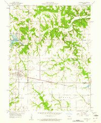
1959 Map of Hunnewell
USGS Topo · Published 1961About this map
Hunnewell serves as the central hub of this 1950s rural landscape, where the Chicago Burlington and Quincy railroad cuts through the heart of the settlement. The town's surroundings are defined by a network of small schools and country churches that anchored the community, including Union Chapel, Sharpsburg Ch, and the Buckman Sch. To the north, the Hunnewell Wildlife Management Area frames Hunnewell Lake, accompanied by a local Fish Hatchery.
Find a feature on this map
26 named features on this map. Tap any name to fly to it.
Don’t see what you’re looking for? This feature index may not catch every label — zoom into the map to look around manually.
Map Details
Editions of this 1959 Hunnewell Map
2 editions found
Other maps of this area

1903 · Palmyra
USGS Topo · 1:125,000

1948 · Quincy
USGS Topo · 1:250,000

1949 · Philadelphia
USGS Topo · 1:24,000

1950 · Philadelphia
USGS Topo · 1:24,000

1956 · Quincy
USGS Topo · 1:250,000

1959 · Monroe City
USGS Topo · 1:24,000

1959 · Lakenan
USGS Topo · 1:24,000

1959 · Joanna
USGS Topo · 1:24,000

1959 · Hunnewell
USGS Topo · 1:24,000
1960 · Goss
USGS Topo · 1:24,000