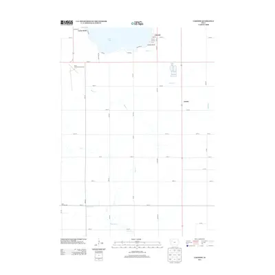
2013 Map of Lakeside
USGS Topo · Published 2013About this map
Storm Lake anchors the northern portion of this quadrangle, where the residential communities of Lakeside and Lakeside Beach line the southeastern shoreline. The map reveals a transition from these lakefront leisure areas, including Casino Beach, to a landscape dominated by the structured grid of Iowa’s agricultural heartland. South of the lake, the Storm Lake Municipal Airport occupies a significant tract of land, while the rural character of the region is emphasized by the presence of the Eden Township Hall further south. The drainage patterns of the area are defined by the meandering courses of Boyer Cr and the Boyer River, which flow across the township lines. The small settlement of Juniata stands along the primary north-south corridor, providing a localized point of interest within the vast network of county roads like Ira Ave and Jackson Ave that divide the fertile prairie into precise sections.
Find a feature on this map
44 named features on this map. Tap any name to fly to it.
Don’t see what you’re looking for? This feature index may not catch every label — zoom into the map to look around manually.
Map Details
Editions of this 2013 Lakeside Map
This is the sole edition of this map. No revisions or reprints were ever made.
Other maps of this area

1954 · Fort Dodge
USGS Topo · 1:250,000

1957 · Fort Dodge
USGS Topo · 1:250,000

1958 · Fort Dodge
USGS Topo · 1:250,000

1979 · Lakeside
USGS Topo · 1:24,000

1979 · Storm Lake
USGS Topo · 1:24,000

1979 · Newell West
USGS Topo · 1:24,000

1979 · Alta
USGS Topo · 1:24,000

1979 · Schaller North
USGS Topo · 1:24,000

1979 · Storm Lake NE
USGS Topo · 1:24,000

1980 · Early
USGS Topo · 1:24,000