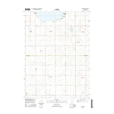
2015 Map of Lakeside
USGS Topo · Published 2015About this map
Storm Lake dominates the northern reaches of this Iowa landscape, its southern shoreline dotted with small residential clusters and recreational areas. The community of Lakeside sits prominently near Lakeside Beach and Outlet Creek, while the northwestern corner of the lake features Casino Beach. This region reflects a well-organized agricultural grid typical of Buena Vista and Sac counties, where a network of section roads like County Road 72 and 130th Avenue connect isolated rural hubs.
Find a feature on this map
58 named features on this map. Tap any name to fly to it.
Don’t see what you’re looking for? This feature index may not catch every label — zoom into the map to look around manually.
Map Details
Editions of this 2015 Lakeside Map
This is the sole edition of this map. No revisions or reprints were ever made.
Other maps of this area

1954 · Fort Dodge
USGS Topo · 1:250,000

1957 · Fort Dodge
USGS Topo · 1:250,000

1958 · Fort Dodge
USGS Topo · 1:250,000

1979 · Lakeside
USGS Topo · 1:24,000

1979 · Storm Lake
USGS Topo · 1:24,000

1979 · Newell West
USGS Topo · 1:24,000

1979 · Alta
USGS Topo · 1:24,000

1979 · Schaller North
USGS Topo · 1:24,000

1979 · Storm Lake NE
USGS Topo · 1:24,000

1980 · Early
USGS Topo · 1:24,000