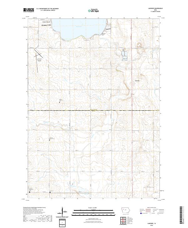
2022 Map of Lakeside
USGS Topo · Published 2022About this map
Storm Lake dominates the northern edge of this Iowa landscape, where the community of Lakeside and recreation spots like Casino Beach and Lakeside Beach line the southern shore. The terrain is defined by the transition from the lake's basin to the headwaters of Boyer Cr and the Boyer River, which meander south across the prairie toward the boundary between Buena Vista and Sac counties. This area is characterized by a high concentration of historic burial grounds, including the Hayes Township Cem, Immanuel Reformed Cem, German Methodist Cem, and Chase Cem, providing essential primary source data for genealogists tracking early families in this section of northwest Iowa. The presence of the Storm Lake Municipal Airport and the settlement at Juniata further illustrate the mix of rural agriculture and modern regional infrastructure.
Find a feature on this map
39 named features on this map. Tap any name to fly to it.
Don’t see what you’re looking for? This feature index may not catch every label — zoom into the map to look around manually.
Map Details
Editions of this 2022 Lakeside Map
This is the sole edition of this map. No revisions or reprints were ever made.
Other maps of this area

1954 · Fort Dodge
USGS Topo · 1:250,000

1957 · Fort Dodge
USGS Topo · 1:250,000

1958 · Fort Dodge
USGS Topo · 1:250,000

1979 · Lakeside
USGS Topo · 1:24,000

1979 · Storm Lake
USGS Topo · 1:24,000

1979 · Newell West
USGS Topo · 1:24,000

1979 · Alta
USGS Topo · 1:24,000

1979 · Schaller North
USGS Topo · 1:24,000

1979 · Storm Lake NE
USGS Topo · 1:24,000

1980 · Early
USGS Topo · 1:24,000