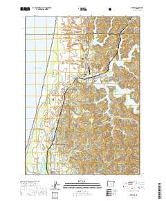
2020 Map of Lakeside
USGS Topo · Published 2020About this map
Lakeside serves as the central hub of this coastal landscape, situated between the sprawling waters of Tenmile Lake and Eel Lake. The community is defined by its relationship with the water and the unique coastal topography, including the massive John Dellenback Dune that rises near the Pacific shore. The infrastructure of the area, including the Lakeside Municipal Airport and the Lakeside Cem, reflects a settled corridor along the Oregon Coast Highway where it skirts the edge of the Siuslaw National Forest.
Find a feature on this map
73 named features on this map. Tap any name to fly to it.
Don’t see what you’re looking for? This feature index may not catch every label — zoom into the map to look around manually.
Map Details
Editions of this 2020 Lakeside Map
This is the sole edition of this map. No revisions or reprints were ever made.
Other maps of this area

1896 · Coos Bay
USGS Topo · 1:125,000

1898 · Coos Bay
USGS Topo · 1:125,000

1900 · Coos Bay
USGS Topo · 1:125,000

1923 · Reedsport
USGS Topo · 1:62,500

1942 · Reedsport
USGS Topo · 1:62,500

1942 · Empire
USGS Topo · 1:62,500

1942 · Coos Bay
USGS Topo · 1:62,500

1944 · Empire
USGS Topo · 1:62,500

1945 · Coos Bay
USGS Topo · 1:62,500

1954 · Coos Bay
USGS Topo · 1:250,000