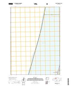
2020 Map of Lakeside OE W
USGS Topo · Published 2020About this map
The Pacific Ocean dominates this coastal survey, where the waters meet the shoreline along the border of Douglas Co and Coos Co. Located south of Winchester Bay and west of the town of Lakeside, this map illustrates the narrow strip of land where the mainland transitions into the open sea. A small corner of the Siuslaw National Forest appears in the southeastern portion of the quadrangle, marking a transition from protected public lands to the coastal marine environment. The map provides a precise look at the 2020 boundary lines between these two Oregon counties and the township coordinates for t24s r13w. It is primarily a maritime and forest boundary document, capturing the coastal edge before it gives way entirely to the Pacific.
Find a feature on this map
4 named features on this map. Tap any name to fly to it.
Don’t see what you’re looking for? This feature index may not catch every label — zoom into the map to look around manually.
Map Details
Editions of this 2020 Lakeside OE W Map
This is the sole edition of this map. No revisions or reprints were ever made.
Other maps of this area

1896 · Coos Bay
USGS Topo · 1:125,000

1898 · Coos Bay
USGS Topo · 1:125,000

1900 · Coos Bay
USGS Topo · 1:125,000

1923 · Reedsport
USGS Topo · 1:62,500

1942 · Reedsport
USGS Topo · 1:62,500

1942 · Empire
USGS Topo · 1:62,500

1942 · Coos Bay
USGS Topo · 1:62,500

1944 · Empire
USGS Topo · 1:62,500

1945 · Coos Bay
USGS Topo · 1:62,500

1954 · Coos Bay
USGS Topo · 1:250,000