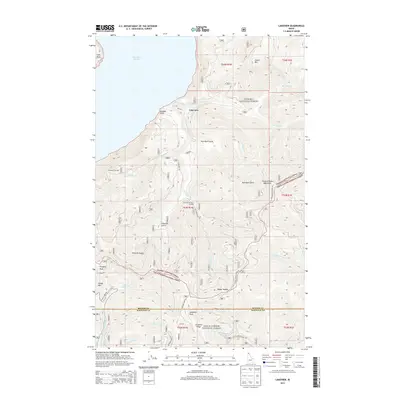
2013 Map of Lakeview
USGS Topo · Published 2013About this map
Lakeview sits on the eastern shore of Lake Pend Oreille, where the foothills of the Coeur d'Alene Mountains meet the water. This 2013 survey illustrates a landscape primarily defined by its transition from the lakeshore at Cape Horn into the dense timberlands of the Kanisku National Forest and Coeur d'Alene National Forest. The map details the complex drainage systems of the region, including Gold Cr and W Gold Cr, which carve through deep features like Kick Bush Gulch and Chloride Gulch.
Find a feature on this map
47 named features on this map. Tap any name to fly to it.
Don’t see what you’re looking for? This feature index may not catch every label — zoom into the map to look around manually.
Map Details
Editions of this 2013 Lakeview Map
This is the sole edition of this map. No revisions or reprints were ever made.
Other maps of this area

1901 · Sandpoint
USGS Topo · 1:125,000

1903 · Rathdrum
USGS Topo · 1:125,000

1909 · Cataldo
USGS Topo · 1:125,000

1911 · Cataldo
USGS Topo · 1:125,000

1911 · Priest Lake
USGS Topo · 1:250,000

1911 · Sandpoint
USGS Topo · 1:125,000

1913 · Priest Lake
USGS Topo · 1:250,000

1949 · Packsaddle Mtn
USGS Topo · 1:62,500

1951 · Packsaddle Mtn
USGS Topo · 1:62,500

1955 · Spokane
USGS Topo · 1:250,000