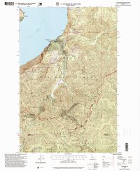
1996 Map of Lakeview
USGS Topo · Published 1999About this map
Mining operations and rugged peaks define this 1990s survey of the shoreline where Lake Pend Oreille meets the steep terrain of the Panhandle. The settlement of Lakeview serves as the primary hub for this district, which was historically shaped by the extraction of silver and other metals. Extensive workings are documented throughout the hills, including the Idaho Lakeview Mine, Keep Cool Mine, and Silver Leaf Mine. The map highlights the intersection of the Kaniksu National Forest and Coeur d'Alene National Forest, with the boundary between Bonner and Kootenai counties bisecting the drainage of the Little North Fork Coeur d'Alene River. For genealogists and local historians, the Lakeview Cemetery (Aband) and various mountain landmarks like Jackknife Peak provide specific points of interest within the vast national forest lands.
Find a feature on this map
40 named features on this map. Tap any name to fly to it.
Don’t see what you’re looking for? This feature index may not catch every label — zoom into the map to look around manually.
Map Details
Editions of this 1996 Lakeview Map
This is the sole edition of this map. No revisions or reprints were ever made.
Other maps of this area

1901 · Sandpoint
USGS Topo · 1:125,000

1903 · Rathdrum
USGS Topo · 1:125,000

1909 · Cataldo
USGS Topo · 1:125,000

1911 · Cataldo
USGS Topo · 1:125,000

1911 · Priest Lake
USGS Topo · 1:250,000

1911 · Sandpoint
USGS Topo · 1:125,000

1913 · Priest Lake
USGS Topo · 1:250,000

1949 · Packsaddle Mtn
USGS Topo · 1:62,500

1951 · Packsaddle Mtn
USGS Topo · 1:62,500

1955 · Spokane
USGS Topo · 1:250,000