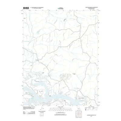
2011 Map of Lakeview Heights
USGS Topo · Published 2011About this map
Lake of the Ozarks dominates the southern landscape of this Missouri Ozarks terrain, where the Cole Camp Creek Arm creates a deeply indented shoreline. The map shows a transition from the structured residential developments of Lakeview Heights and Camp Oakledge along the water to the more dispersed rural settlements of Hilda and Edmonson to the north. These inland areas are marked by significant topographic features like Mount Hulda and Leeder Bluff, reflecting the winding drainage patterns of Ross Creek and Byler Branch.
Find a feature on this map
95 named features on this map. Tap any name to fly to it.
Don’t see what you’re looking for? This feature index may not catch every label — zoom into the map to look around manually.
Map Details
Editions of this 2011 Lakeview Heights Map
This is the sole edition of this map. No revisions or reprints were ever made.
Other maps of this area

1887 · Warsaw
USGS Topo · 1:125,000

1894 · Warsaw
USGS Topo · 1:125,000

1935 · Edwards
USGS Topo · 1:24,000

1935 · Dell
USGS Topo · 1:24,000

1935 · Boylers Mill
USGS Topo · 1:24,000

1935 · Knobby Creek
USGS Topo · 1:24,000

1936 · Lakeview Heights
USGS Topo · 1:24,000

1936 · Schuyler
USGS Topo · 1:24,000

1945 · Fristoe
USGS Topo · 1:62,500

1947 · Jefferson City
USGS Topo · 1:250,000