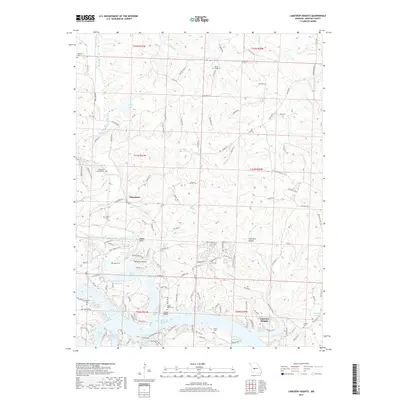
2017 Map of Lakeview Heights
USGS Topo · Published 2017About this map
Lake of the Ozarks defines the southern portion of this region, where fingers of water like Turkey Creek Cove and Spring Branch Cove reach into the upland terrain. The map documents a rural landscape characterized by numerous small family and community burial grounds, including Mount Hulda Cem and Yeager Union Cem, which offer significant value for genealogical research in this part of Benton County. Settlements are concentrated around Edmonson and the lakeside community of Lakeview Heights. North of the water, the topography is carved by drainages such as Cole Camp Creek and Flat Rock Cr, creating a complex network of ridges and hollows like Sam Allen Hollow. The road system reflects this terrain, with winding routes such as Edmonson Rd and State Hwy W connecting the small inland communities and lakeside developments.
Find a feature on this map
183 named features on this map. Tap any name to fly to it.
Don’t see what you’re looking for? This feature index may not catch every label — zoom into the map to look around manually.
Map Details
Editions of this 2017 Lakeview Heights Map
This is the sole edition of this map. No revisions or reprints were ever made.
Other maps of this area

1887 · Warsaw
USGS Topo · 1:125,000

1894 · Warsaw
USGS Topo · 1:125,000

1935 · Edwards
USGS Topo · 1:24,000

1935 · Dell
USGS Topo · 1:24,000

1935 · Boylers Mill
USGS Topo · 1:24,000

1935 · Knobby Creek
USGS Topo · 1:24,000

1936 · Lakeview Heights
USGS Topo · 1:24,000

1936 · Schuyler
USGS Topo · 1:24,000

1945 · Fristoe
USGS Topo · 1:62,500

1947 · Jefferson City
USGS Topo · 1:250,000