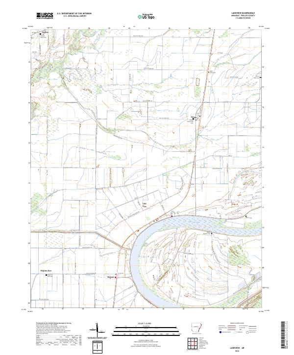
2024 Map of Lakeview
USGS Topo · Published 2024About this map
Lake View serves as the focal point of this Phillips County landscape, situated just north of the massive horseshoe bend of Old Town Lake. The town's grid of streets, including Martin Luther King Dr and Wall St, contrasts with the surrounding agricultural sections of the Mississippi Delta. This area is characterized by its legacy of small settlements and community gathering places, visible through the numerous cemeteries that anchor the map, such as Oneida Community Cem and Saint Johns Cem.
Find a feature on this map
57 named features on this map. Tap any name to fly to it.
Don’t see what you’re looking for? This feature index may not catch every label — zoom into the map to look around manually.
Map Details
Editions of this 2024 Lakeview Map
This is the sole edition of this map. No revisions or reprints were ever made.
Other maps of this area

1939 · Farrell
USGS Topo · 1:62,500

1939 · Modoc
USGS Topo · 1:62,500

1939 · Latour
USGS Topo · 1:62,500

1940 · Marvell
USGS Topo · 1:62,500

1948 · Helena
USGS Topo · 1:250,000

1948 · Modoc
USGS Topo · 1:62,500

1950 · Helena
USGS Topo · 1:250,000

1955 · Latour
USGS Topo · 1:62,500
1955 · Farrell
USGS Topo · 1:62,500

1955 · Helena
USGS Topo · 1:250,000