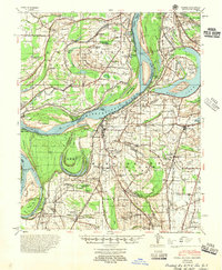
1955 Map of Farrell
USGS Topo · Published 1955About this map
The Mississippi River dominates this mid-century landscape, revealing a complex history of shifting currents through features like the Horseshoe Cut-Off (1848) and the Montezuma Cut-Off 1856-1875. These radical changes in the river's path created distinct islands and bars, such as Montezuma Bar and Alcorn Island, while leaving behind oxbows like Horseshoe Lake. The delta land is densely dotted with small rural institutions that speak to the region's social history, including the Coahoma County Agricultural Sch, the Sheriff Ridge Sch, and the Saunders Chapel & Cem.
Find a feature on this map
122 named features on this map. Tap any name to fly to it.
Don’t see what you’re looking for? This feature index may not catch every label — zoom into the map to look around manually.
Map Details
Editions of this 1955 Farrell Map
This is the sole edition of this map. No revisions or reprints were ever made.
Other maps of this area

1908 · Lula
USGS Topo · 1:24,000

1908 · Dundee
USGS Topo · 1:24,000

1908 · Coahoma
USGS Topo · 1:24,000

1908 · Moon Lake
USGS Topo · 1:24,000

1908 · Jonestown
USGS Topo · 1:24,000

1910 · Dundee
USGS Topo · 1:31,680

1910 · Coahoma
USGS Topo · 1:31,680

1910 · Jonestown
USGS Topo · 1:31,680

1912 · Moon Lake
USGS Topo · 1:31,680

1912 · Lula
USGS Topo · 1:31,680