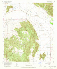
1953 Map of Lakeview
USGS Topo · Published 1965About this map
The Lakeview Mountains dominate this mid-century landscape, providing a dramatic backdrop to the developing agricultural and water infrastructure of Riverside County. At the northern base of Mt Rudolph, the community of Lakeview is mapped alongside irrigation features like the Colorado River Aqueduct and the San Jacinto River. The presence of several Quarries and a Quarry suggest active mineral extraction during this period, while the Bar V Ranch and Casa Loma reflect the rural residential character of the valley floor. To the south, the terrain levels out at Juniper Flat before descending through Reinhardt Canyon toward the valley. This 1953 survey captures the area just as the region's complex water management systems, including the San Jacinto Reservoir and various gaging stations, were becoming central to the local economy and land use patterns.
Find a feature on this map
50 named features on this map. Tap any name to fly to it.
Don’t see what you’re looking for? This feature index may not catch every label — zoom into the map to look around manually.
Map Details
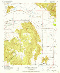
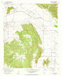
Editions of this 1953 Lakeview Map
3 editions found
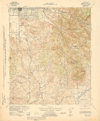
Other maps of this area

1901 · Southern California Sheet No. 1
USGS Topo · 1:250,000

1901 · San Jacinto
USGS Topo · 1:125,000

1901 · Elsinore
USGS Topo · 1:125,000

1904 · Southern California Sheet No. 1
USGS Topo · 1:250,000

1942 · Banning
USGS Topo · 1:62,500

1942 · Hemet
USGS Topo · 1:62,500

1942 · Murrieta
USGS Topo · 1:62,500

1942 · Perris
USGS Topo · 1:62,500

1943 · Perris
USGS Topo · 1:62,500
1943 · Hemet
USGS Topo · 1:62,500