1967 Map of Lakeview
USGS Topo · Published 1979About this map
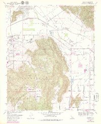
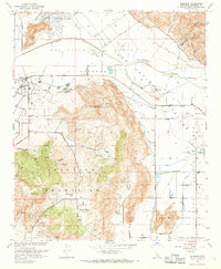
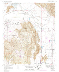
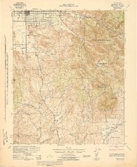
Lakeview serves as the primary settlement on this Southern California landscape, situated between the expansive floodplains of the San Jacinto River and the rising terrain to the south. The map documents a rural environment where water management is central to the land's utility, evidenced by the presence of numerous Duck Ponds and local infrastructure. The Bar V Ranch occupies a prominent position in the foothills, reflecting the area's agricultural and ranching heritage during the mid-20th century. By the late 1970s, as shown through photogrammetric revisions, the region maintained its character as a productive river valley basin defined by its proximity to the San Jacinto waterway.
Find a feature on this map
5 named features on this map. Tap any name to fly to it.
Don’t see what you’re looking for? This feature index may not catch every label — zoom into the map to look around manually.
Map Details
Editions of this 1967 Lakeview Map
4 editions found

Other maps of this area

1901 · Southern California Sheet No. 1
USGS Topo · 1:250,000

1901 · San Jacinto
USGS Topo · 1:125,000

1901 · Elsinore
USGS Topo · 1:125,000

1904 · Southern California Sheet No. 1
USGS Topo · 1:250,000

1942 · Banning
USGS Topo · 1:62,500

1942 · Hemet
USGS Topo · 1:62,500

1942 · Murrieta
USGS Topo · 1:62,500

1942 · Perris
USGS Topo · 1:62,500

1943 · Perris
USGS Topo · 1:62,500
1943 · Hemet
USGS Topo · 1:62,500