
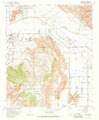
1967 Map of Lakeview
USGS Topo · Published 1986About this map
The Lakeview Mountains dominate this 1967 survey, providing a sharp topographic contrast to the surrounding valley floor. Along the northern edge, the San Jacinto River flows through a landscape marked by numerous Duck Ponds and a complex water management system including the Colorado River Aqueduct and the San Jacinto Reservoir. The small settlement of Lakeview sits at the base of the mountains, while the interior upland includes landmarks like Mt Rudolph and the historically significant Maze Stone Historical Marker. This period shows the transition of the San Jacinto region, where traditional ranching at the Bar V Ranch and natural features like Juniper Springs exist alongside modern infrastructure like Sewage Disposal Ponds and a Gaging Station. Old travel routes like Stagecoach Road remain visible, tracing the foothills south of Y Potrero.
Find a feature on this map
40 named features on this map. Tap any name to fly to it.
Don’t see what you’re looking for? This feature index may not catch every label — zoom into the map to look around manually.
Map Details
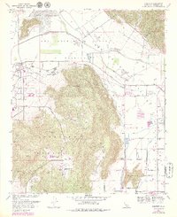
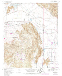
Editions of this 1967 Lakeview Map
4 editions found
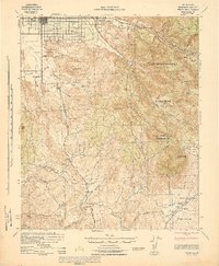
Other maps of this area

1901 · Southern California Sheet No. 1
USGS Topo · 1:250,000

1901 · San Jacinto
USGS Topo · 1:125,000

1901 · Elsinore
USGS Topo · 1:125,000

1904 · Southern California Sheet No. 1
USGS Topo · 1:250,000

1942 · Banning
USGS Topo · 1:62,500

1942 · Hemet
USGS Topo · 1:62,500

1942 · Murrieta
USGS Topo · 1:62,500

1942 · Perris
USGS Topo · 1:62,500

1943 · Perris
USGS Topo · 1:62,500
1943 · Hemet
USGS Topo · 1:62,500