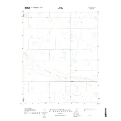
2019 Map of Lakeview
USGS Topo · Published 2019About this map
The small settlement of Lakeview occupies the heart of this High Plains landscape, situated along a prominent east-west transit corridor in Swisher County. The terrain is defined by the winding course of Middle Tule Draw, which carves a distinct path through the otherwise flat agricultural and ranching acreage. This 2019 survey illustrates the organized, grid-like development of the region, where a network of county roads like Co RD J and Co RD R segment the land for modern use. The western edge of the map identifies the jurisdictional boundary between Castro Co and Swisher Co, highlighting the map's location on the county line. Numerous small depressions and wetlands are scattered across the quadrangle, indicative of the playa lakes characteristic of the Texas Panhandle's geography.
Find a feature on this map
18 named features on this map. Tap any name to fly to it.
Don’t see what you’re looking for? This feature index may not catch every label — zoom into the map to look around manually.
Map Details
Editions of this 2019 Lakeview Map
This is the sole edition of this map. No revisions or reprints were ever made.
Other maps of this area

1954 · Plainview
USGS Topo · 1:250,000

1954 · Clovis
USGS Topo · 1:250,000

1958 · Clovis
USGS Topo · 1:250,000

1958 · Plainview
USGS Topo · 1:250,000

1965 · Hart
USGS Topo · 1:24,000

1965 · Edmonson NE
USGS Topo · 1:24,000

1965 · Tulia
USGS Topo · 1:24,000

1965 · Lakeview
USGS Topo · 1:24,000

1965 · Happy
USGS Topo · 1:24,000

1965 · Nazareth
USGS Topo · 1:24,000