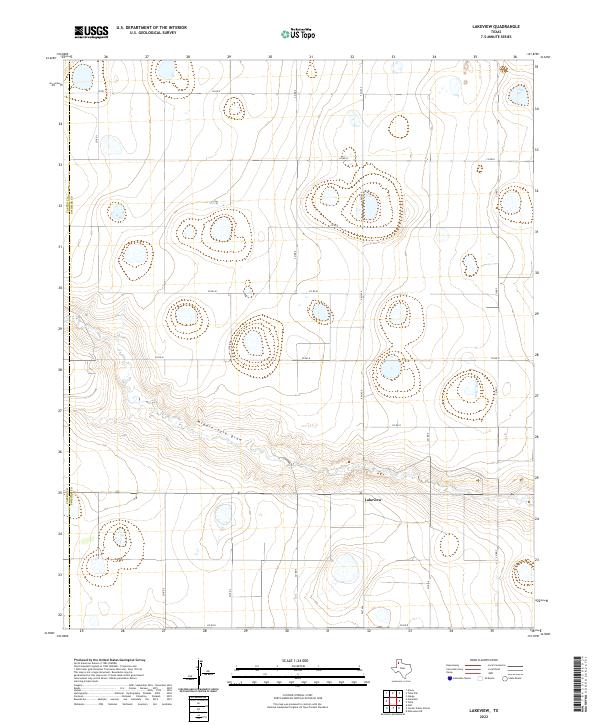
2022 Map of Lakeview
USGS Topo · Published 2022About this map
Middle Tule Draw carves a distinct east-west path across this Panhandle landscape, defining the local topography between the vast agricultural sections of the Southern High Plains. The small community of Lakeview is situated south of the draw, serving as a focal point for the surrounding rural road network. This grid-based system of county roads, including Co Rd J and Co Rd 7, reflects the orderly land partition typical of the region's agricultural history. On the western edge of the sheet, the boundary between Castro Co and Swisher Co marks the intersection of administrative jurisdictions. The presence of numerous depression-like features across the plains suggests the localized hydrology that characterizes this part of Texas, where surface water is often seasonal and dependent on these natural basins.
Find a feature on this map
17 named features on this map. Tap any name to fly to it.
Don’t see what you’re looking for? This feature index may not catch every label — zoom into the map to look around manually.
Map Details
Editions of this 2022 Lakeview Map
This is the sole edition of this map. No revisions or reprints were ever made.
Other maps of this area

1954 · Plainview
USGS Topo · 1:250,000

1954 · Clovis
USGS Topo · 1:250,000

1958 · Clovis
USGS Topo · 1:250,000

1958 · Plainview
USGS Topo · 1:250,000

1965 · Hart
USGS Topo · 1:24,000

1965 · Edmonson NE
USGS Topo · 1:24,000

1965 · Tulia
USGS Topo · 1:24,000

1965 · Lakeview
USGS Topo · 1:24,000

1965 · Happy
USGS Topo · 1:24,000

1965 · Nazareth
USGS Topo · 1:24,000