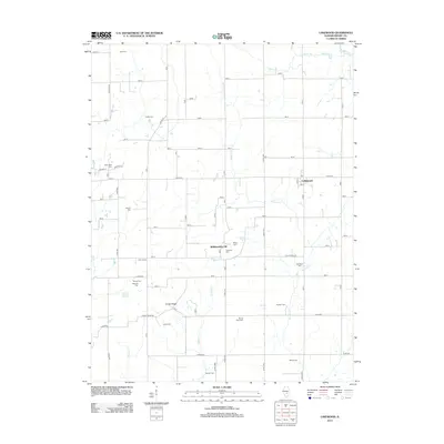
2012 Map of Lakewood
USGS Topo · Published 2012About this map
Lakewood serves as a central hub in this rural landscape, featuring its local Po and proximity to the distinct elevation of Williamsburg Hill. The terrain is defined by a dense network of family-named cemeteries and landmarks that suggest a deeply rooted community history, including New Hope Cem, Mount Olive Cem, and the Town House. Waterways like Mitchell Cr, Becks Cr, and Polecat Cr weave through the sectioned farmland, following the natural drainage patterns of the area. To the south, Corley Ridge provides a prominent landform, while the surveyor's grid is occasionally interrupted by traditional routes such as Cold Spring Rd and Corley Ridge Rd. This 2012 survey illustrates the persistence of small Illinois settlements and the enduring presence of historic burial sites across the Shelby County countryside.
Find a feature on this map
36 named features on this map. Tap any name to fly to it.
Don’t see what you’re looking for? This feature index may not catch every label — zoom into the map to look around manually.
Map Details
Editions of this 2012 Lakewood Map
This is the sole edition of this map. No revisions or reprints were ever made.
Other maps of this area

1941 · St. Elmo
USGS Topo · 1:62,500

1942 · Shelbyville
USGS Topo · 1:62,500

1944 · Ramsey
USGS Topo · 1:62,500

1945 · St. Elmo
USGS Topo · 1:62,500

1946 · Shelbyville
USGS Topo · 1:62,500

1946 · Ramsey
USGS Topo · 1:62,500

1947 · Pana
USGS Topo · 1:62,500

1949 · Pana
USGS Topo · 1:62,500

1958 · Decatur
USGS Topo · 1:250,000

1961 · Decatur
USGS Topo · 1:250,000