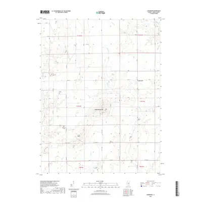
2018 Map of Lakewood
USGS Topo · Published 2018About this map
Williamsburg Hill rises as a prominent landmark in this section of Shelby County, overlooking a landscape defined by meandering creek beds and numerous rural burial grounds. The settlement of Lakewood sits along the eastern edge, while the small community of Corley and the Robinson area anchor the southern and northern reaches. The terrain is deeply carved by waterways including Mitchell Cr, Polecat Cr, and Becks Cr, creating a network of ridges such as Corley Ridge. This survey is particularly valuable for genealogical research, as it identifies over a dozen named cemeteries scattered across the townships, including Mount Olive Cem, Bateman Cem, and New Hope Cem. The road network, including Co Hwy 12 and Corley Ridge Rd, follows the high ground and section lines, revealing the enduring spatial organization of this Illinois farming region.
Find a feature on this map
36 named features on this map. Tap any name to fly to it.
Don’t see what you’re looking for? This feature index may not catch every label — zoom into the map to look around manually.
Map Details
Editions of this 2018 Lakewood Map
This is the sole edition of this map. No revisions or reprints were ever made.
Other maps of this area

1941 · St. Elmo
USGS Topo · 1:62,500

1942 · Shelbyville
USGS Topo · 1:62,500

1944 · Ramsey
USGS Topo · 1:62,500

1945 · St. Elmo
USGS Topo · 1:62,500

1946 · Shelbyville
USGS Topo · 1:62,500

1946 · Ramsey
USGS Topo · 1:62,500

1947 · Pana
USGS Topo · 1:62,500

1949 · Pana
USGS Topo · 1:62,500

1958 · Decatur
USGS Topo · 1:250,000

1961 · Decatur
USGS Topo · 1:250,000