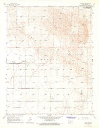
1966 Map of Lakin SW
USGS Topo · Published 1967About this map
The Arkansas river flows through the northeast corner of this Kearny Co landscape, marking a stark transition between the river bottom and the high plains of western Kansas. Just south of the river, the Southside Ditch mirrors the watercourse, a vital component of the region's agricultural infrastructure during the mid-1960s. The northern half of the map is dominated by a complex field of Sand Dunes, a geological signature of the Arkansas River Valley.
Find a feature on this map
58 named features on this map. Tap any name to fly to it.
Don’t see what you’re looking for? This feature index may not catch every label — zoom into the map to look around manually.
Map Details
Editions of this 1966 Lakin SW Map
2 editions found
Other maps of this area

1891 · Larned
USGS Topo · 1:125,000

1900 · Syracuse
USGS Topo · 1:125,000

1900 · Lakin
USGS Topo · 1:125,000

1920 · Syracuse
USGS Topo · 1:125,000

1955 · Dodge City
USGS Topo · 1:250,000

1958 · Dodge City
USGS Topo · 1:250,000

1959 · Dodge City
USGS Topo · 1:250,000

1959 · Ulysses NW
USGS Topo · 1:24,000

1959 · Big Bow NE
USGS Topo · 1:24,000

1959 · Ulysses NE
USGS Topo · 1:24,000