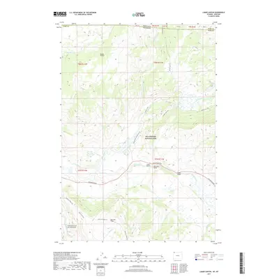
2017 Map of Lamar Canyon
USGS Topo · Published 2017About this map
Yellowstone National Park reveals its dramatic geological and hydrological character in this contemporary survey of the Absaroka Range. The landscape is dominated by the confluence of major waterways and high-altitude features like the Buffalo Plateau and Specimen Ridge. The northern reach of the Grand Canyon of the Yellowstone is visible at the southwestern edge, while the Lamar River winds through its namesake Lamar Canyon and into the broad Lamar Valley.
Find a feature on this map
36 named features on this map. Tap any name to fly to it.
Don’t see what you’re looking for? This feature index may not catch every label — zoom into the map to look around manually.
Map Details
Editions of this 2017 Lamar Canyon Map
This is the sole edition of this map. No revisions or reprints were ever made.
Other maps of this area

1886 · Canyon
USGS Topo · 1:125,000

1891 · Livingston
USGS Topo · 1:250,000

1893 · Livingston
USGS Topo · 1:250,000

1895 · Canyon
USGS Topo · 1:125,000

1896 · Canyon
USGS Topo · 1:125,000

1901 · Canyon
USGS Topo · 1:125,000

1907 · Canyon
USGS Topo · 1:125,000

1911 · Canyon
USGS Topo · 1:125,000

1940 · Mt Wallace
USGS Topo · 1:62,500

1942 · Cutoff Mtn
USGS Topo · 1:62,500