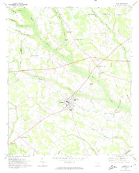
1969 Map of Lamar
USGS Topo · Published 1974About this map
Lamar stands as the central hub of this coastal plain landscape, where the town's grid is surrounded by a network of rural crossroads and family-named landmarks. The convergence of numerous named crossings, such as Whites Crossroads and Carters Crossroads, indicates a long-standing pattern of community nodes centered around transportation and agriculture. The terrain is defined by the winding course of Sparrow Swamp and its tributaries, which dictate the placement of local infrastructure like the Old Millpond Railroad Grade and the Andrews Millpond.
Find a feature on this map
43 named features on this map. Tap any name to fly to it.
Don’t see what you’re looking for? This feature index may not catch every label — zoom into the map to look around manually.
Map Details
Editions of this 1969 Lamar Map
This is the sole edition of this map. No revisions or reprints were ever made.
Other maps of this area

1940 · Florence West
USGS Topo · 1:62,500

1941 · Spartanburg
USGS Topo · 1:250,000

1945 · Florence West
USGS Topo · 1:62,500

1953 · Florence
USGS Topo · 1:250,000

1953 · Spartanburg
USGS Topo · 1:250,000

1954 · Florence
USGS Topo · 1:250,000

1960 · Spartanburg
USGS Topo · 1:250,000

1963 · Spartanburg
USGS Topo · 1:250,000

1963 · Darlington West
USGS Topo · 1:24,000

1964 · Spartanburg
USGS Topo · 1:250,000