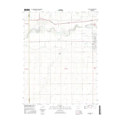
2016 Map of Lamar West
USGS Topo · Published 2016About this map
The Arkansas River corridor in Prowers County is defined here by an intricate network of irrigation engineering, supporting agricultural life on the high plains. In this 2016 survey, the western edge of Lamar appears with a detailed street grid featuring family-named avenues and residential blocks. Water management is the dominant landscape feature, with the Amity Canal, Fort Bent Canal, and Riverview Ditch carving precise paths across the river's northern and southern banks. This reliance on water rights is further evidenced by the Wiley Drainage Ditch and the Vista Del Rio Ditch, which redirect flow through the surrounding sections. Outside the urban center, the small settlement of Beta and the Lamar Municipal Airport stand as isolated landmarks. For those studying the local history of the region, the location of Crawford Cem and the complex drainage patterns of Dry Cr and Willow Cr offer valuable insights into the rural development and burial sites of this eastern Colorado community.
Find a feature on this map
46 named features on this map. Tap any name to fly to it.
Don’t see what you’re looking for? This feature index may not catch every label — zoom into the map to look around manually.
Map Details
Editions of this 2016 Lamar West Map
This is the sole edition of this map. No revisions or reprints were ever made.
Other maps of this area

1892 · Lamar
USGS Topo · 1:125,000

1892 · Two Butte
USGS Topo · 1:125,000

1893 · Two Butte
USGS Topo · 1:125,000

1952 · Lamar West
USGS Topo · 1:24,000

1953 · Lamar East
USGS Topo · 1:24,000

1953 · Prowers
USGS Topo · 1:24,000

1954 · Lamar
USGS Topo · 1:250,000

1955 · McClave
USGS Topo · 1:24,000

1955 · May Valley
USGS Topo · 1:24,000

1955 · Wiley
USGS Topo · 1:24,000