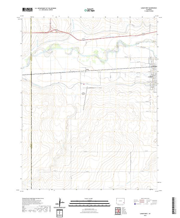
2022 Map of Lamar West
USGS Topo · Published 2022About this map
The Arkansas River corridor defines the landscape of western Lamar and the nearby settlement of Beta, where an intricate network of irrigation infrastructure supports the region's agricultural economy. Extensive water management systems including the Amity Canal, Riverview Ditch, Vista Del Rio Ditch, and Fort Bent Canal crisscross the valley, illustrating a century-long effort to direct river water to the High Plains. While the eastern edge of the sheet captures the urban grid of Lamar along N 13th St and W Park St, the central portion is dominated by open terrain and the Lamar Municipal Airport. This 2022 survey also documents the county boundary between Bent County and Prowers County, showing how property lines and rural roads like Co RD HH follow the rectangular Public Land Survey System even as natural features like Dry Cr and Willow Cr wind across the southern reaches.
Find a feature on this map
55 named features on this map. Tap any name to fly to it.
Don’t see what you’re looking for? This feature index may not catch every label — zoom into the map to look around manually.
Map Details
Editions of this 2022 Lamar West Map
This is the sole edition of this map. No revisions or reprints were ever made.
Other maps of this area

1892 · Lamar
USGS Topo · 1:125,000

1892 · Two Butte
USGS Topo · 1:125,000

1893 · Two Butte
USGS Topo · 1:125,000

1952 · Lamar West
USGS Topo · 1:24,000

1953 · Lamar East
USGS Topo · 1:24,000

1953 · Prowers
USGS Topo · 1:24,000

1954 · Lamar
USGS Topo · 1:250,000

1955 · McClave
USGS Topo · 1:24,000

1955 · May Valley
USGS Topo · 1:24,000

1955 · Wiley
USGS Topo · 1:24,000