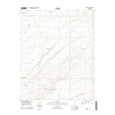
2014 Map of Lamb Well
USGS Topo · Published 2014About this map
Jeddito Wash winds diagonally through this high-desert landscape, tracing the topographic shifts between Antelope Mesa and the surrounding canyon country. The map documents a sparsely populated region defined by traditional Navajo and Hopi settlement patterns, centered around the community of Jeddito in the southwest and the historic enclave of Kearms Canyon in the northwest. Bureau of Indian Affairs routes, such as Bia-9110 and Bia-9101, serve as the primary lifelines through the drainage basins. Cultural landmarks like Kokopnyama and the eponymous Lamb Well reflect the area's deep ties to the land and the critical importance of water sources. The transition from the flat tablelands of the mesa to the intricate gullies of the wash illustrates the geographic challenges of the Colorado Plateau in the early 21st century.
Find a feature on this map
19 named features on this map. Tap any name to fly to it.
Don’t see what you’re looking for? This feature index may not catch every label — zoom into the map to look around manually.
Map Details
Editions of this 2014 Lamb Well Map
This is the sole edition of this map. No revisions or reprints were ever made.
Other maps of this area

1883 · Tusayan
USGS Topo · 1:250,000

1886 · Tusayan
USGS Topo · 1:250,000

1886 · Fort Defiance
USGS Topo · 1:250,000

1892 · Fort Defiance
USGS Topo · 1:250,000

1947 · Flagstaff
USGS Topo · 1:250,000

1954 · Flagstaff
USGS Topo · 1:250,000

1954 · Gallup
USGS Topo · 1:250,000

1958 · Gallup
USGS Topo · 1:250,000

1958 · Flagstaff
USGS Topo · 1:250,000

1959 · Gallup
USGS Topo · 1:250,000