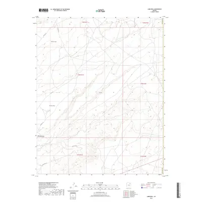
2018 Map of Lamb Well
USGS Topo · Published 2018About this map
Keams Canyon and the settlement of Kokopnyama are the primary hubs of activity in this high desert landscape within the Fort Defiance Agency. The terrain is dominated by the broad elevation of Antelope Mesa, which slopes toward the winding drainage of Jeddito Wash. This 2018 survey reveals a network of local transportation routes, including Indian Rte 65 and Rout 9101, which connect the scattered points of interest across the Navajo County landscape. The location of Lamb Well serves as a named landmark amidst the township and range boundaries of the region. The map provides a detailed view of the modern infrastructure and natural geographic features that characterize this portion of the Arizona desert, illustrating how water sources like the wash and established routes dictate the placement of local settlements.
Find a feature on this map
17 named features on this map. Tap any name to fly to it.
Don’t see what you’re looking for? This feature index may not catch every label — zoom into the map to look around manually.
Map Details
Editions of this 2018 Lamb Well Map
This is the sole edition of this map. No revisions or reprints were ever made.
Other maps of this area

1883 · Tusayan
USGS Topo · 1:250,000

1886 · Tusayan
USGS Topo · 1:250,000

1886 · Fort Defiance
USGS Topo · 1:250,000

1892 · Fort Defiance
USGS Topo · 1:250,000

1947 · Flagstaff
USGS Topo · 1:250,000

1954 · Flagstaff
USGS Topo · 1:250,000

1954 · Gallup
USGS Topo · 1:250,000

1958 · Gallup
USGS Topo · 1:250,000

1958 · Flagstaff
USGS Topo · 1:250,000

1959 · Gallup
USGS Topo · 1:250,000