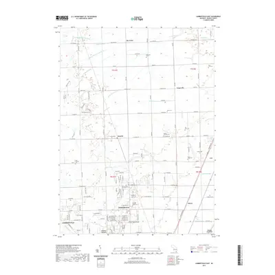
2019 Map of Lambertville East
USGS Topo · Published 2019About this map
Temperance and Lambertsville anchor this 2019 study of southern Monroe County, just north of the Michigan-Ohio border. The landscape is defined by an extensive network of drainage systems such as the Summerfield and Ida Drain and Fitzgerald Drain, which support the agricultural tracts between established communities. This map reveals the modern transition of historical hamlets into residential corridors, as seen in the growth around Samaria and Greystone Manor. Local history is preserved through numerous family and community burial grounds, including the Neriah Cem and Weeks Cem. Institutional presence is noted at the Monroe County Community College Whitman Center, while smaller settlements like Ida Center and Yargerville retain their distinct identity along the section lines of the Public Land Survey System.
Find a feature on this map
140 named features on this map. Tap any name to fly to it.
Don’t see what you’re looking for? This feature index may not catch every label — zoom into the map to look around manually.
Map Details
Editions of this 2019 Lambertville East Map
This is the sole edition of this map. No revisions or reprints were ever made.
Other maps of this area

1900 · Maumee Bay
USGS Topo · 1:62,500

1900 · Toledo
USGS Topo · 1:62,500

1912 · Monroe
USGS Topo · 1:62,500

1912 · Dundee
USGS Topo · 1:62,500

1914 · Monroe
USGS Topo · 1:62,500

1926 · Dundee
USGS Topo · 1:62,500

1927 · Monroe
USGS Topo · 1:31,680

1934 · Point Place
USGS Topo · 1:24,000

1936 · Samaria
USGS Topo · 1:31,680
1936 · Erie
USGS Topo · 1:31,680
Featured Places
- Bedford Township, MI
- Temperance, Bedford Township
- LaSalle Township, MI
- Ida Township, MI
- Erie Township, MI