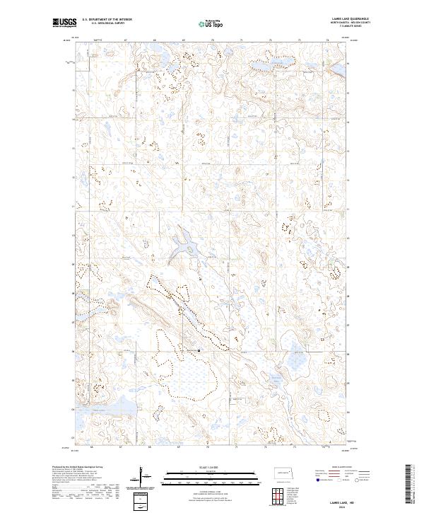
2024 Map of Lambs Lake
USGS Topo · Published 2024About this map
The Lambs Lake National Wildlife Refuge and the adjacent Nelson County Waterfowl Production Area dominate the central landscape of this section of Nelson County. This region is characterized by a high density of wetlands and glacial lakes, including Stella Lake in the north and Harrison Lake further south. The prevalence of these water bodies highlights the area's importance as a critical habitat within the prairie pothole region. Settlement is largely distributed along a grid of section roads such as Co Rd 4 and 117th Ave NE. In the southern portion of the map, the Melrose Cem stands as a quiet marker of the local community's history, situated near the transition between townships t152n r58w and t151n r58w.
Find a feature on this map
27 named features on this map. Tap any name to fly to it.
Don’t see what you’re looking for? This feature index may not catch every label — zoom into the map to look around manually.
Map Details
Editions of this 2024 Lambs Lake Map
This is the sole edition of this map. No revisions or reprints were ever made.
Other maps of this area

1939 · Niagara
USGS Topo · 1:62,500

1942 · McVille
USGS Topo · 1:62,500

1952 · Grand Forks
USGS Topo · 1:250,000

1952 · Thief River Falls
USGS Topo · 1:250,000

1952 · New Rockford
USGS Topo · 1:250,000

1953 · Devils Lake
USGS Topo · 1:250,000

1956 · New Rockford
USGS Topo · 1:250,000

1956 · Thief River Falls
USGS Topo · 1:250,000

1956 · Devils Lake
USGS Topo · 1:250,000

1956 · Grand Forks
USGS Topo · 1:250,000