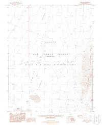
1987 Map of Lambs Pond
USGS Topo · Published 1988About this map
Nellis Air Force Range (Restricted Area) and the Nevada Wild Horse Management Area overlap across this high-desert basin in Nye County. The landscape is dominated by the Kawich Depression, a broad valley floor dotted with intermittent water features like Antelope Reservoir and Lambs Pond. The presence of numerous Target markers across the terrain indicates the area's primary use for military training and aerial observation during the late 20th century.
Find a feature on this map
11 named features on this map. Tap any name to fly to it.
Don’t see what you’re looking for? This feature index may not catch every label — zoom into the map to look around manually.
Map Details
Editions of this 1987 Lambs Pond Map
This is the sole edition of this map. No revisions or reprints were ever made.
Other maps of this area

1908 · Kawich
USGS Topo · 1:250,000

1942 · Reveille Peak
USGS Topo · 1:125,000

1942 · Wheelbarrow Peak
USGS Topo · 1:125,000

1952 · Quartzite Mtn
USGS Topo · 1:62,500

1952 · Wheelbarrow Peak
USGS Topo · 1:62,500

1952 · Silent Canyon
USGS Topo · 1:62,500

1952 · Belted Peak
USGS Topo · 1:62,500

1954 · Goldfield
USGS Topo · 1:250,000

1955 · Goldfield
USGS Topo · 1:250,000

1958 · Goldfield
USGS Topo · 1:250,000