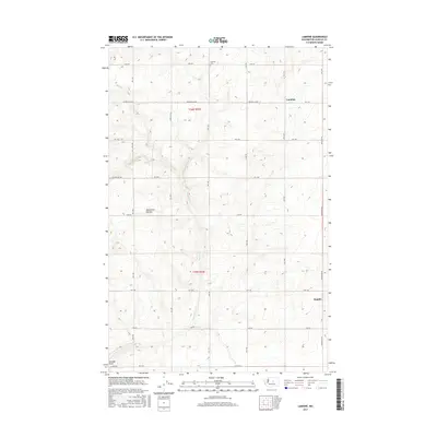
2017 Map of Lamoine
USGS Topo · Published 2017About this map
Waterville Plateau dominates this high-plain landscape in Douglas County, characterized by the geometric precision of the Public Land Survey System. The small settlement of Lamoine sits at a crossroads in the northeastern quadrant, while Supplee marks a point of interest further south along Supplee Rd NW. The terrain is defined by the incision of Douglas Cr, which carves through the plateau and leads into the topographic depression of Douglas Draw.
Find a feature on this map
25 named features on this map. Tap any name to fly to it.
Don’t see what you’re looking for? This feature index may not catch every label — zoom into the map to look around manually.
Map Details
Editions of this 2017 Lamoine Map
This is the sole edition of this map. No revisions or reprints were ever made.
Other maps of this area

1901 · Chelan
USGS Topo · 1:125,000

1953 · Ritzville
USGS Topo · 1:250,000

1957 · Wenatchee
USGS Topo · 1:250,000

1959 · Ritzville
USGS Topo · 1:250,000

1965 · Ritzville
USGS Topo · 1:250,000

1968 · Withrow
USGS Topo · 1:24,000

1968 · Chelan
USGS Topo · 1:24,000

1968 · Lamoine
USGS Topo · 1:24,000

1968 · Chelan Falls
USGS Topo · 1:24,000
1968 · Alstown
USGS Topo · 1:24,000