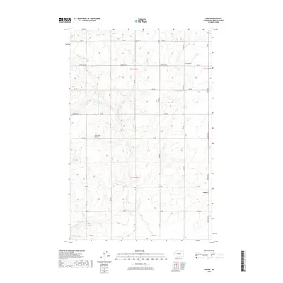
2020 Map of Lamoine
USGS Topo · Published 2020About this map
The Waterville Plateau dominates this section of Douglas County, characterized by a high-altitude agricultural landscape deeply incised by the drainage of Douglas Cr. This 2020 survey documents the enduring rural structure of the region, where a precise grid of county roads, such as Gibson Rd NW and Logan Rd NW, provides access to expansive dryland farming tracts. The small settlement of Lamoine sits at a junction in the northeastern portion of the map, while the locality of Supplee is positioned to the south near the junction of Supplee Rd NW. Local history is anchored at the Fletcher Cem near the northern boundary, providing a focal point for genealogical research. The presence of Elevator Rd near the southern reaches of the creek suggests the historical importance of grain transport in this high-desert wheat-growing country.
Find a feature on this map
29 named features on this map. Tap any name to fly to it.
Don’t see what you’re looking for? This feature index may not catch every label — zoom into the map to look around manually.
Map Details
Editions of this 2020 Lamoine Map
This is the sole edition of this map. No revisions or reprints were ever made.
Other maps of this area

1901 · Chelan
USGS Topo · 1:125,000

1953 · Ritzville
USGS Topo · 1:250,000

1957 · Wenatchee
USGS Topo · 1:250,000

1959 · Ritzville
USGS Topo · 1:250,000

1965 · Ritzville
USGS Topo · 1:250,000

1968 · Withrow
USGS Topo · 1:24,000

1968 · Chelan
USGS Topo · 1:24,000

1968 · Lamoine
USGS Topo · 1:24,000

1968 · Chelan Falls
USGS Topo · 1:24,000
1968 · Alstown
USGS Topo · 1:24,000