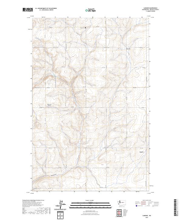
2023 Map of Lamoine
USGS Topo · Published 2023About this map
Douglas Creek carves a winding path through the high basalt terrain of the Waterville Plateau in this modern survey of Douglas County. The landscape is defined by the geometric grid of the Public Land Survey System, where agricultural access roads like Waterville N Rd and 9 Rd NW cross the plateau to reach isolated settlements. The community of Lamoine sits at a crossroads in the northern section of the map, while Supplee occupies a position near the southeastern edge, illustrating the dispersed nature of habitation in this dry wheat-growing region. Genealogy researchers will find the Fletcher Cem positioned along the northern township line, a small historical marker in a vast landscape of coulees and draws, including the prominent Douglas Draw. The road network, featuring names like Elevator Rd, hints at the deep-seated grain economy that has long sustained these upland communities.
Find a feature on this map
29 named features on this map. Tap any name to fly to it.
Don’t see what you’re looking for? This feature index may not catch every label — zoom into the map to look around manually.
Map Details
Editions of this 2023 Lamoine Map
This is the sole edition of this map. No revisions or reprints were ever made.
Other maps of this area

1901 · Chelan
USGS Topo · 1:125,000

1953 · Ritzville
USGS Topo · 1:250,000

1957 · Wenatchee
USGS Topo · 1:250,000

1959 · Ritzville
USGS Topo · 1:250,000

1965 · Ritzville
USGS Topo · 1:250,000

1968 · Withrow
USGS Topo · 1:24,000

1968 · Chelan
USGS Topo · 1:24,000

1968 · Lamoine
USGS Topo · 1:24,000

1968 · Chelan Falls
USGS Topo · 1:24,000
1968 · Alstown
USGS Topo · 1:24,000