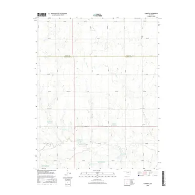
2016 Map of Lamont SE
USGS Topo · Published 2016About this map
The agricultural plains of the Grant County and Garfield County line are defined here by a extensive network of water management sites developed along the upper reaches of the Red Rock Creek watershed. This survey details numerous reservoirs including Upper Red Rock Cr Site 43 Reservoir and Upper Red Rock Creek Site 22 Reservoir, which catch the drainage from small tributaries like Negro Cr and Hereford Cr. The landscape is etched with a precise grid of rural section roads, including EH Holden Rd and Kremlin-Hunter Rd, providing access to the expansive farmsteads of North Central Oklahoma. For genealogists, the map preserves the locations of local landmarks such as Mount Vernon Cem in the northeast and Heltholt Cem situated near the intersection of several county roads, offering a clear record of the area's established burial grounds and settlement patterns.
Find a feature on this map
38 named features on this map. Tap any name to fly to it.
Don’t see what you’re looking for? This feature index may not catch every label — zoom into the map to look around manually.
Map Details
Editions of this 2016 Lamont SE Map
This is the sole edition of this map. No revisions or reprints were ever made.
Other maps of this area

1955 · Enid
USGS Topo · 1:250,000

1956 · Garber
USGS Topo · 1:62,500

1958 · Enid
USGS Topo · 1:250,000

1968 · Lamont SE
USGS Topo · 1:24,000

1968 · Lamont NW
USGS Topo · 1:24,000

1968 · Billings
USGS Topo · 1:24,000

1968 · Hunter
USGS Topo · 1:24,000

1968 · Eddy
USGS Topo · 1:24,000

1968 · Lamont
USGS Topo · 1:24,000

1972 · Perry NW
USGS Topo · 1:24,000