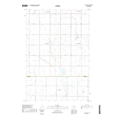
2017 Map of LaMoure SW
USGS Topo · Published 2017About this map
The border of LaMoure Co and Dickey Co bisects this prairie landscape, where the agricultural grid is defined by a rigorous network of section roads like 72nd St SE and 94th Ave SE. At the center of the local landscape lies Cottonwood Lake, a significant water body fed by the meandering Cottonwood Cr as it winds through the northeastern township. This area preserves elements of communal and private land use, evidenced by the Fairview Colony Cem located just east of the creek. Toward the southern extent of the survey, the Larson Airport represents modern rural infrastructure, while the dominance of township and range lines like t133n r62w highlights the enduring Public Land Survey System that continues to organize the North Dakota plains.
Find a feature on this map
28 named features on this map. Tap any name to fly to it.
Don’t see what you’re looking for? This feature index may not catch every label — zoom into the map to look around manually.
Map Details
Editions of this 2017 LaMoure SW Map
This is the sole edition of this map. No revisions or reprints were ever made.
Other maps of this area

1894 · Monango
USGS Topo · 1:62,500

1894 · La Moure
USGS Topo · 1:62,500

1894 · Fullerton
USGS Topo · 1:62,500

1895 · Lamoure
USGS Topo · 1:125,000

1896 · Edgeley
USGS Topo · 1:125,000

1918 · La Moure
USGS Topo · 1:125,000

1925 · Edgeley
USGS Topo · 1:125,000

1952 · Grand Rapids
USGS Topo · 1:24,000

1953 · Jamestown
USGS Topo · 1:250,000

1955 · Fullerton NE
USGS Topo · 1:24,000