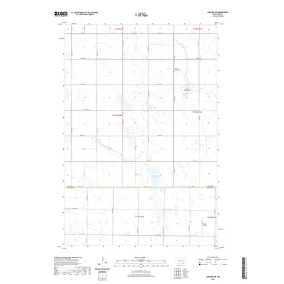
2020 Map of LaMoure SW
USGS Topo · Published 2020About this map
Cottonwood Lake and the winding course of Cottonwood Cr anchor this agricultural landscape along the border of LaMoure and Dickey Counties. The terrain is defined by a rigorous section-line road grid, including 78th St SE which tracks the county line, and a network of avenues such as 94th Ave SE. For genealogists and local historians, the presence of the Immanuel Lutheran Cem and Fairview Colony Cem provides specific points of interest within the rural townships. The southern portion of the quadrangle features the Larson Airport, highlighting the region's reliance on small-scale aviation for transport and crop management. The map illustrates a contemporary view of North Dakota's prairie economy, where the land is meticulously divided into the Public Land Survey System townships of t133n r62w and its neighbors.
Find a feature on this map
30 named features on this map. Tap any name to fly to it.
Don’t see what you’re looking for? This feature index may not catch every label — zoom into the map to look around manually.
Map Details
Editions of this 2020 LaMoure SW Map
This is the sole edition of this map. No revisions or reprints were ever made.
Other maps of this area

1894 · Monango
USGS Topo · 1:62,500

1894 · La Moure
USGS Topo · 1:62,500

1894 · Fullerton
USGS Topo · 1:62,500

1895 · Lamoure
USGS Topo · 1:125,000

1896 · Edgeley
USGS Topo · 1:125,000

1918 · La Moure
USGS Topo · 1:125,000

1925 · Edgeley
USGS Topo · 1:125,000

1952 · Grand Rapids
USGS Topo · 1:24,000

1953 · Jamestown
USGS Topo · 1:250,000

1955 · Fullerton NE
USGS Topo · 1:24,000