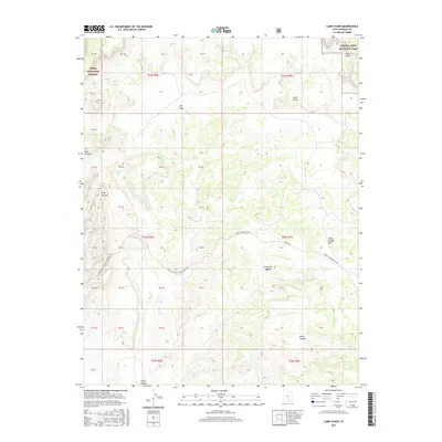
2017 Map of Lamp Stand
USGS Topo · Published 2017About this map
Dixie National Forest and Capitol Reef National Park meet in this high-desert landscape of Garfield County, defined by its dramatic geologic formations. The topographic data reveals a complex network of canyons, including Wolverine Canyon, Long Canyon, and Horse Canyon, which carve through the high plateaus. A significant historical transit route, the road from Moab to Boulder Town and the Burr Trl, provides the primary means of navigating this remote terrain. Distinctive landmarks such as the Lamp Stand and the broad White Canyon Flat offer orientation points for those tracing the history of Utah's backcountry. The map also highlights the Circle Cliffs and the sweeping expanse of The Flats, illustrating the stark transition between sheer canyon walls and elevated grazing lands.
Find a feature on this map
19 named features on this map. Tap any name to fly to it.
Don’t see what you’re looking for? This feature index may not catch every label — zoom into the map to look around manually.
Map Details
Editions of this 2017 Lamp Stand Map
This is the sole edition of this map. No revisions or reprints were ever made.
Other maps of this area

1885 · Fish Lake
USGS Topo · 1:250,000

1886 · Escalante
USGS Topo · 1:250,000

1896 · Fish Lake
USGS Topo · 1:250,000

1952 · Notom 4 SE
USGS Topo · 1:24,000

1952 · Notom 4 SW
USGS Topo · 1:24,000

1952 · Notom 3 SE
USGS Topo · 1:24,000

1952 · Grover
USGS Topo · 1:62,500

1952 · Notom
USGS Topo · 1:62,500

1953 · Circle Cliffs 1 SE
USGS Topo · 1:24,000

1953 · Circle Cliffs 2 NE
USGS Topo · 1:24,000